kestenbaum AI test
Lot 139:
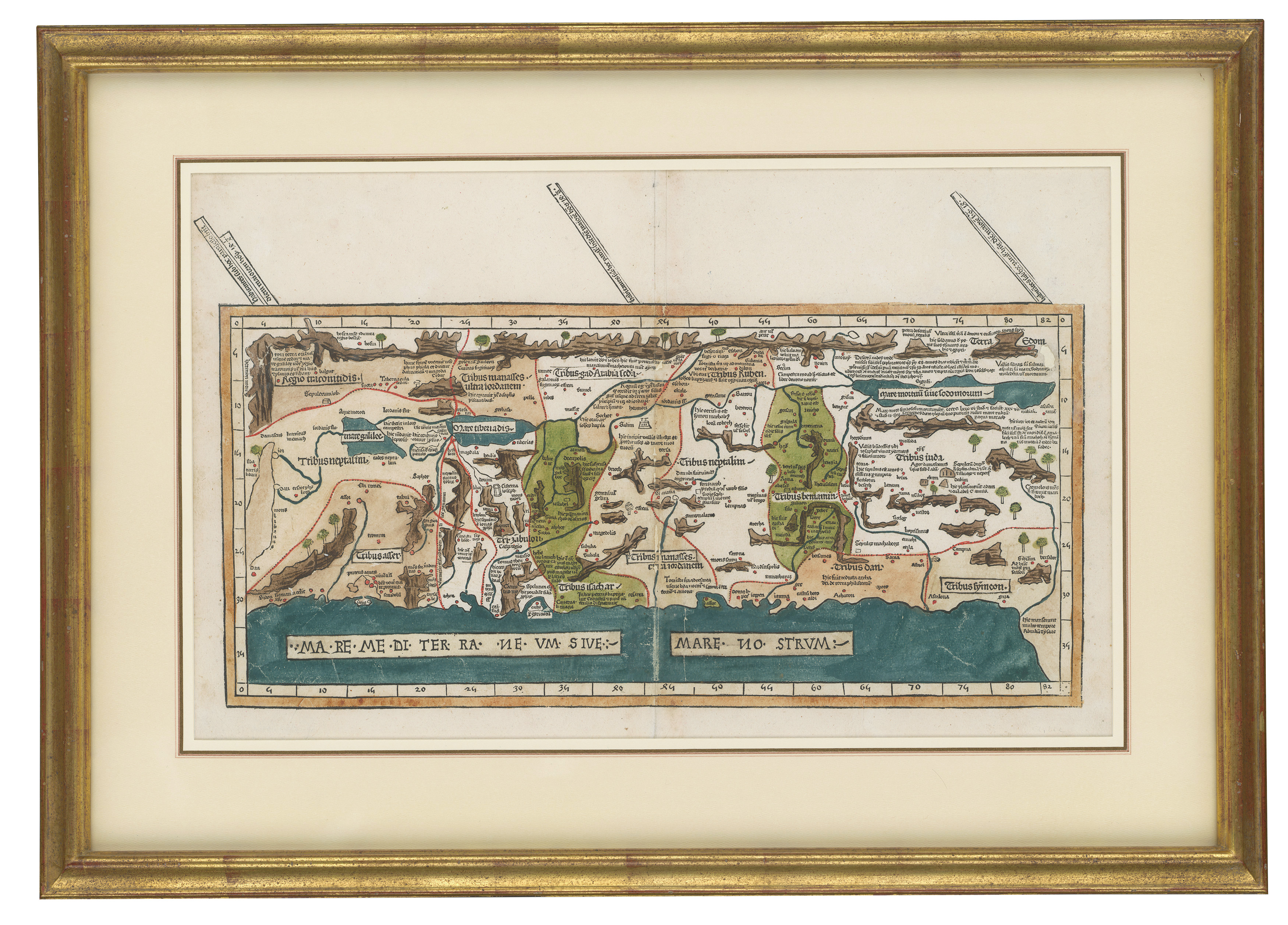
Description
This item is a historic pictoric map, described as an antique vintage reproduction. It depicts the Holy Land, based on descriptions and co-ordinates given in Cosmographica by Ptolemy (Claudius Ptolemaeus of Alexandria), originally published in Ulm, Germany, by Johann Reger. The map is titled ‘[Terra sancta Tabula moderna]’ and measures 44in x 33in. It is categorized as posters & prints.
Condition report:
No condition details provided in source material.
Share this lot: